A flood warning and cell phone notification on Sunday morning, March 8 alerted people to the fact that flooding in the Mad River as well as the Au Sable River in New York was possible. Today, March 12 also started with a flood watch due to rain and snow melt over the last few days.

The Sunday notification got a few folks out of bed and down to check out Bridge Street where the Mad River was ice-jammed above and below the Covered Bridge, with the ice backed up to just before the bend by Couples’ Club field. There was water moving under the ice and some water was starting to creep up the banks by the Bridge Street Marketplace parking lot by 8:15 a.m.
Further downstream, the river was flowing freely at Tremblay bridge and Meadow Road bridge and into Moretown where it was rushing through the gorges at the south end of the village and in the middle of the village.
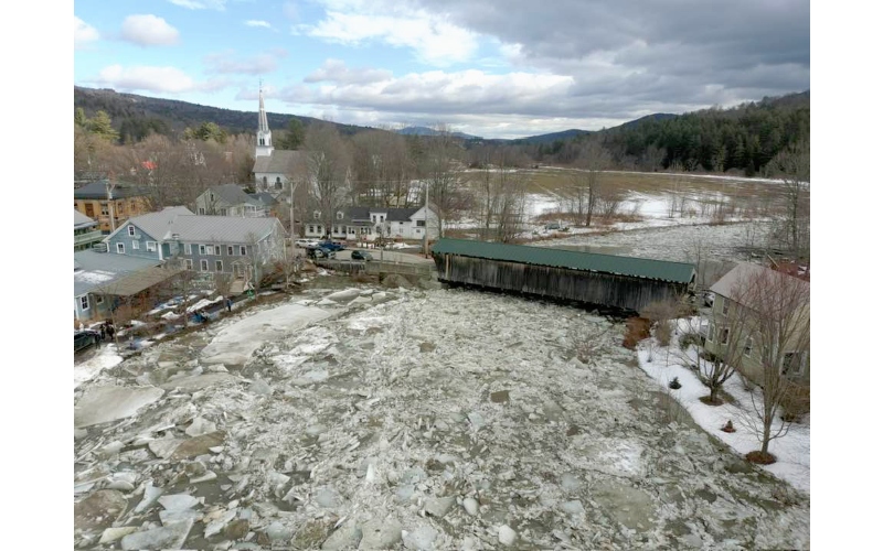 Photo by Andy Yager
North of Moretown, Spillway Road off Route 100B led to Bridge Road across the Mad River which was completely iced-in and the river had carved its own temporary path under the east side of the bridge. For those who have never seen it, but who’ve consulted it, the USGS stream gage is at the edge of the Mad River at the corner of Spillway Road and Bridge Road. It’s an upright plywood rectangle with a small solar collector on top and a measuring device on the side with a relatively newly build ramp leading to it from Spillway Road. Further north and all the way to Middlesex, the river ran freely.
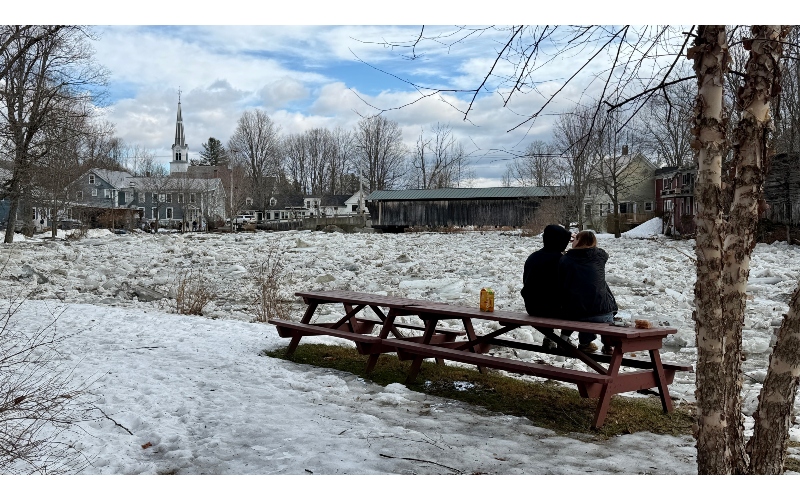 Photo by Jon Williams
Circling back to Bridge Street, there were lots of folks wandering along Bridge Street and through the Bridge Street Marketplace. The southern parking lot had begun to fill with water and the picnic tables near the river had been moved back, but some where inundated. The ice on the north side of the bridge began breaking up as water percolated under the ice creating smaller clear spots that grew as the morning went on.
A third trip back to Bridge Street in the afternoon found more parking in the parking lots with water filling the lot in front of the Reign Vermont building and the river creating its own course around the ice by way of the back of the Reign Vermont building, running across the parking lot and re-entering the river closer to the Twisted Halo parking lot. There was a lot of activity along the river and along Bridge Street and the Covered Bridge as people lined up to watch the ice heave and the river takes its temporary course.
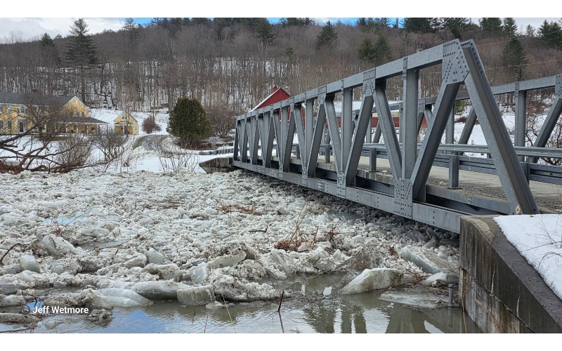 Photo by Jeff Wetmore
The town’s Pocket Park on Bridge Street filled up with water that was then trapped by enormous slabs of ice, some well over a foot-thick and others as big as the first floor of a house. Water was moving visibly under and through the ice with some spots showing almost clear areas and waves of water breaking through. Mad River Valley Television’s webcam on the Scrag and Roe building was on throughout the day and was popular with those watching from afar as were social media posts featuring the ice and the river. The ice broke up during the night and by Monday morning March 9 the river was running freely under the Covered Bridge. -just in time for today’s flood warning.