By Rachel Goff
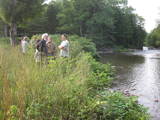
On Tuesday, July 29, a group gathered at Riverside Park in Warren to discuss future maintenance for the floodplain property.
Right now, Riverside Park "looks probably the best it has all summer," Warren Select Board chair Andy Cunningham said, as the grass had been mowed earlier that day. It's not what it used to be, residents agreed, but that could be OK.
Warren accepted ownership of the Route 100 property from a Federal Emergency Management Agency (FEMA) buyout following the flood of 1998. With a sandy bank and a grassy lawn, Riverside Park became a popular place for swimming, picnicking and Frisbee tossing before its landscape changed drastically due to flooding from Tropical Storm Irene in August of 2011.
Standing in the middle of the lawn on Tuesday, it was easy to see where the Mad River cut through the property during Irene and again during flooding from the July 3 storm last summer, carving divots in the field and scattering rocks across its surface.
In the years to come, scientists from the Vermont Agency of Natural Resources (ANR) "think the [river] will cut through here but not stay here," executive director of Friends of the Mad River Corrie Miller said, explaining that the piece of land will act as a "secondary channel."
According to Miller, Riverside Park lies in a spot where the Mad River straightens out and if water were not allowed to go through the park during storms, the next spot the river would attempt to straighten out would be at Sugarbush Resort's snowmaking pond just north off Route 100.
From an ecological standpoint, it would be best to let Riverside Park grow wild so it can best serve as a riparian buffer, Miller explained, but that plan comes in contradiction to its usage as a recreation area.
Right now, "there are very few places in Warren where you can access the river without going across someone's land," select board member Matt Groom said at a meeting earlier this month, speaking to the niche Riverside Park occupies in the community.
On Tuesday, residents and elected officials walked through Riverside Park to identify spots where it could be allowed to grow wild and spots where it could be safely maintained for use as a swimming hole, including a gently sloping area at the northern end of the river's bank.
The town could mow parts of the field to funnel people to the more protected areas, Cunningham proposed, and perhaps the best plan is to use the property as "an educational piece," he said. Warren could put up a sign identifying the area as a floodplain and explaining the erosion forces at work. "We would start by probably renaming [the park]," he said, "so the expectations are changed."
If the town continues to lightly maintain the property, over time it will see what works and what doesn't, one resident told the board. The property could be a "long-term learning process, if you listen to what the river's telling you."
{loadnavigation}


