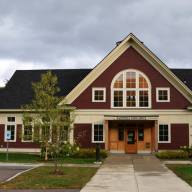
The Mad River Valley Conservation and Recreation Visioning (CRV) group hosted a public forum on May 29 at the Lareau Farm pavilion in Waitsfield.
Before community members broke into small groups to discuss what they envision for the future of recreation and conservation in The Valley – feedback the CRV steering committee said they would draw on in their work, the audience heard a presentation by the consulting firm Arrowwood Environmental, Huntington, Vermont, which was hired last fall to collect data.
Arrowwood consultants inventoried over 340 miles of hiking trails on both public and private land, as well as swim holes, canoe launches, parking lots and other features of the recreational landscape. The consultants pointed out that hiking, biking, snowmobiling and alpine ski areas are well balanced in The Valley. They also mapped ecological features like vernal pools, flood plain forests, river corridors and areas with rare and endangered species.
Following a period of data collection, consultants created an online visual mapping tool in which users can select certain data sets, zooming in on specific features of The Valley to learn more.
GAPS IN DATA
The consultants pointed to some gaps in their data collection as well. They said that Warren, Waitsfield, and Fayston already possessed some data about recreation and the environment, as each town had already worked with Arrowwood to inventory some of their resources. The state’s Fish and Wildlife Department, the consultants said, has encouraged towns to take such inventory to inform their town plans and zoning regulations.
The consultants said there is a shortage of data about wetlands in Moretown and Duxbury, and that information about wildlife corridors across The Valley is lacking. Data on invasive species, too, is “woefully incomplete,” they said.
The data on invasive plant species utilized by Arrowwood came from the Mad River Valley’s profile on iNaturalist – a web platform and app in which residents can record their observations about the natural environment via notes and photos. If more residents recorded their observation through the app, that data could be useful for wildlife corridor mapping, the consultants said. “The struggle comes with the disparate nature of the information,” they added, “but the more that kind of stuff gets used, the more valuable it becomes over time.”
‘CITIZEN SCIENCE’
A community member asked how ‘citizen science’ efforts – research conducted with public participation, or amateur research – might be useful in contributing to what is still unknown about The Valley’s ecology. Arrowwood consultants said that the Vermont Center for Ecostudies will train Valley residents to study and assess local vernal pools. They said that residents can also engage with professionals in their communities to study plant species – organizing walks, “to go and botanize, and see if you find anything.”
CRV was formed in late 2022 as part of the Vermont Outdoor Recreation Economic Collaborative (VOREC) grant that the Mad River Valley Chamber of Commerce and local recreation groups received to link Waitsfield and Irasville to The Valley’s trail networks via a bridge over the Mill Brook behind the Localfolk Smokehouse in Waitsfield. A 15-member steering committee was formed and split into two working groups, with one focusing on ‘ecological integrity’ and the other looking at Valley trails and other recreational opportunities. The project budget, spanning about 18 months, was $100,000. The entire VOREC grant was $400,000.
Huffman said the group doesn’t have regulatory authority when it comes to conservation and recreation, but has “the soft power of influence” that comes from sharing information and collaborating. With outdoor recreation activities and local ecology, “We were trying to achieve a better balance,” Huffman said.
CRV working groups are currently finishing drafts that outline The Valley’s “current conditions” for recreation and conservation – essentially “a distillation of where things stand right now,” Huffman said. Members are using an approach developed by federal land managers called the Visitor Use Management Planning (VUMP) process. It illuminates how land is currently utilized, develops desired conditions for the future, then identifies management techniques to achieve those desired outcomes.
This fall, the CRV steering committee will host one or two additional public forums. Funding for their work will expire in December, but Huffman said the group will continue in some capacity.


