The Waitsfield Select Board is seeking specific details about crosswalk sight lines and proposed grades for a new section of the Mad River Path that will connect the pending Mad River Recreation Hub to Irasville and Waitsfield Village.
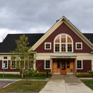
The board met Monday, July 11, to consider questions raised in a June 27 site visit. The Mad River Recreation Hub will be created over the next 18 months with funding from a Vermont Outdoor Recreation and Economic Collaboration (VOREC) grant. It will be developed behind the Local Folk Smokehouse and include parking for up to 80 cars, a visitors’ center, a bridge over the Mill Brook connecting Irasville and Waitsfield to Dana Hill and the Howe Block of Camel’s Hump State Forest along with Mad River Rider’s trails.
That project includes two proposed crosswalks to connect the rec hub to Waitsfield’s sidewalks as well as the Mad River Path. The southern crosswalk will cross Route 100 at the southern end of the field behind the rec hub between the Mad River Valley Real Estate building and the former Jamison Insurance building, connecting to Dugway Road and proceeding north to the parking lot of Blue Stone, then along the Route 100 right of way to a spot near or between Addison West and the Clayton private home on Route 100 where a second crosswalk will connect to the sidewalk system and connected trails.
SECTION 1111 PERMIT
The two crosswalks require that the town apply for a Section 1111 permit from VTrans on behalf of the Mad River Path and before doing that the board wants more specific information from VTrans on whether the site distances for both crosswalks are sufficient.
“For me, the number one big question is whether or not there is an ample sight distance for the Route 100 crosswalk. We need an answer to that before we spend more time and effort. If that answer is no, there is no point in doing all that other planning. I want an answer from VTrans and I know that John Kaplan said there is sufficient sight distance but I want it in black and white on that southern crosswalk,” board chair Christine Sullivan said.
Ross Saxton, executive director of the Mad River Path, said that in an email exchange with VTrans engineer John Kaplan after the site visit, he said both locations had adequate stopping distances from both approaches.
“The only way to get a yes or no answer is to get a response to the Section 1111 application from them,” Saxton said.
VTRANS FEEDBACK
Saxton explained that applying for a Section 1111 permit could be viewed as a step in the process for getting VTrans feedback rather than the be all end all of the pedestrian path portion of the rec hub.
“It can be used to get further information and feedback to adapt our next version of a Section 1111 application,” Saxton said.
Town administrator Annie Decker Dell’Isola said she had talked to Ed Pierce who would be the VTrans District 6 person to review a section 1111 application and confirmed that it would be a way to get more concrete feedback.
Another area of concern for the select board is the berm, grade and retaining wall that will be required to bring the grade of the path from Dugway Road up to the Blue Stone parking lot as well as stormwater plans for that hillside trail.
Board member Brian Shupe wanted assurance that those details on proposed grade and stormwater plans would come from an engineer rather than design build from an excavating contractor. Saxton confirmed that those details would be forthcoming from an engineer and that the proposed grade of the hillside would be 8% and navigable with ADA compliance.
The board discussed with Saxton and Joshua Schwartz, executive director of the Mad River Valley Planning District, whether aligning the path along Route 100 makes more sense than using an alternative route that runs through Fiddlers Green and comes out onto Route 100 by the Irasville Cemetery.
DIRECT ROUTE BEST
Saxton and Decker Dell’Isola said that the collective opinion of those working on the project is that the direct route is the best because people tend to take the most obvious route even if it is along Route 100 without a path.
Shupe noted that the location of that second crosswalk is impacted by the board’s further consideration at the meeting of VTrans’ plans to study the Route 17/100 intersection and the bridge over the Mill Brook. A Fayston and Waitsfield and VTrans planning process for bridge replacement and potential intersection realignment took place from 1983 through 2003 with 16 alternatives considered. A T-intersection was considered as well as potentially re-routing Route 100 to a private drive that connects to the Eagles’ driveway among others.
At this week’s select board hearing the board discussed VTrans’ plans and the fact that the bridge is five to 10 years out from needing replacement.
“So, we’re talking about maintenance, not realignment?” Sullivan asked.
“It’s about what the scope of the intersection discussion is. The bridge straddles two towns. I asked how discreet is the bridge discussion. The answer I got was that there are no eminent needs for the bridge,” explained Schwartz.
The current alignment of the bridge is geometrically insufficient, he said and Sullivan suggested that that alignment may be functioning as a way to slow drivers as they cross the bridge.
“I would be interested in what we can do in terms of traffic calming measures that could slow traffic without altering the intersection,” she added.
The town will be working with VTrans on studying the intersection this fall.