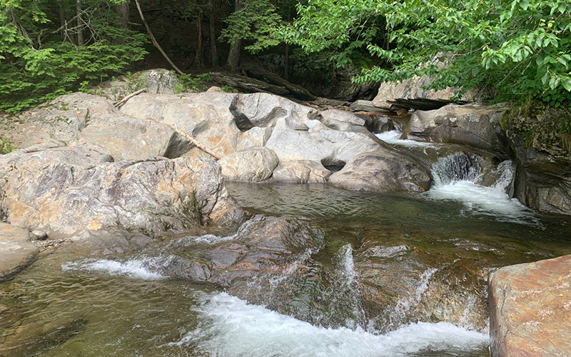
On June 25 and 26, teams of Mad River Watch volunteers visited their field sites to collect data and make environmental observations for the first time this summer. This article is part of an ongoing series that shares highlights from this field work as well as lessons learned from this year and the past 39 years of Friends of the Mad River’s Mad River Watch program. This summer’s articles will focus on exploring the Mad River in the context of its surrounding watershed.
CLIMATE CHANGE
Water gets to the Mad in one of two ways, either above ground as surface flow or below ground as groundwater. In either case, the water in the river starts its journey as precipitation (rain, snow, hail, etc.). The water seen across The Valley reflects the weather and, over time, the climate.
“As the climate in Vermont gets warmer and wetter, we might see more water in our streams. But just because there is more water over the course of a given season or year, doesn’t mean the Valley won’t dry out from time to time. In fact, climate change might also lead to greater variability in our weather. This means that we may actually see an increase in days with low flow in the Mad River even as the total water passing through the watershed increases. Big storms can dump a lot of water in a short time. The steep valley walls will flush those big storms downstream quickly,” explained Ira Shadis, Friends of the Mad River executive director.
Warmer winters and winter rain also have an impact. Historically, the melting of the snowpack in spring has provided a slow and consistent recharge to groundwater and the many small tributaries across The Valley. When that snowpack melts in a midwinter thaw or rainstorm, the water from the snow flushes out of the watershed sooner in the year. The result can be very low flows and drought-like conditions in the spring, Shadis said.
NESTING WATERSHEDS
Flow conditions can also look quite different depending on where in the watershed one is.
“As you climb higher up into the watersheds, the smaller tributaries get steeper and even flashier,” Shadis said.
The Mad River has at least 15 major tributaries, and countless smaller streams, that are each contained by their own watershed. Near the Granville Gulf, the Mad River is so small that one can step across it in some areas. The same is true for many of the tributaries as they wind up into the hills. Like the Mad River, the flow of water in these tributaries reflects the land around them (from soil type to forest cover), the steepness of the stream itself, the material in the stream (think boulders, fallen trees, and aquatic plants), and the presence of human-made infrastructure like roads, culverts, and dams. The flow in each tributary will respond to precipitation based on how these factors help slow and absorb the energy and volume of water that lands in their watershed.
MORETOWN GAGE
By the time the Mad River reaches the USGS gage in Moretown, it has picked up water from each of the major tributaries. On June 24, before the recent rain storms, the USGS gage measured a discharge (flow) of 53 cubic feet per second. By the time the earliest volunteers visited their field sites, at 7 a.m. on Sunday morning, June 25, the gage measured 405 cubic feet per second. Volunteer observations help build understanding of the flow higher upstream and in each of the tributaries. Of the 23 flow observations recorded by volunteers, two were high, two were low, with the rest moderate.
NOTES FROM THE FIELD
“River flowing steadily. A wonderful sound. Lincoln Brook has carved a beautiful channel of boulders and holes and rocks. Still pristine. Level is higher than last Thursday, June 22, when I visited it for training. Maybe an inch higher and the flat rock we chose to test from is now under water,” noted Mad River Watch volunteer, Alex Maclay.


